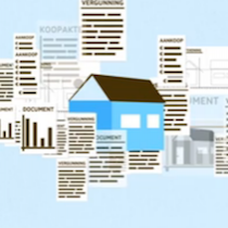
Dutch government information on interactive maps
Government on the map
Interactive maps are an excellent means to publish government information on the internet. But what requirements must be met? Envolve has developed a vision for the Dutch government and a realization strategy.
View example on http://www.overheid.nl/overheidsinformatie/bekendmakingen
Citizens prefer maps
A lot of government information concerns specific locations or areas. Citizens therefore prefer to use maps. But what are the requirements regarding these maps? Is it wise to use Google Maps on a government website? How can we add information? How do we make sure that the communication department is able to work with it? The Ministry of the Interior and Kingdom Relations and ICTU commissioned a study, in order to be able to establish a best practice. The project was called GEOZET (Geographical Search and Display service).
Our job
Paul Francissen, partner in Envolve, supervised this multiannual project from visioning until realization. This included forming a consortium, a business case, project approach and financing.
Commitment first
Cooperation agreements were made between different ministries, the cadastre and land registry, PDOK (Programme for Public Services on the Map), Geonovum (National Spatial Data Infrastructure (NSDI) executive committee in the Netherlands), the Ministry of Infrastructure and the Environment, provinces and municipalities. Together with the major stakeholders, a detailed analysis was made of the requirements. A covenant committed parties up to the highest level. This turned out to be an important success factor.
The result
Envolve brought together the worlds of geoICT and government communication. This resulted in a solution that meets the requirements of the Dutch government. With a user centred design. A unique feature is that the map is accessible for visually handicapped people. And what about Google Maps? It was decided not to use it.
Innovation goes on
By choosing an open source solution (based on Open Layers) and a services based architecture with open standards, we succeeded to keep the innovation process going after the project was concluded.